Guajira Desert
Guajira Desert
In northeast Colombie, the Guajira peninsula blends dunes, Caribbean beaches and Wayuu villages. Complete guide to prepare the journey from Riohacha.
At the far northeast of Colombie, the Guajira desert sprawls across a peninsula where dunes meet the Caribbean Sea. It is the ancestral territory of the Wayuu people, accessible from the city of Riohacha. Cactus-studded plains, ochre cliffs, deserted beaches and fishing villages compose a harsh landscape, rarely frequented, that demands careful planning.
Why visit the Guajira desert
The Guajira stands apart for bringing together three rare elements in Colombie: a semi-arid climate, an unbroken Caribbean coastline and the strong presence of an indigenous nation, the Wayuu. The department remains among the poorest in the country, with limited access to potable water, which partly explains its isolation and lack of conventional tourist infrastructure. Travelers come seeking raw landscapes, encounters with local communities and the experience of trails traversed in 4x4 vehicles.
Wayuu history and culture
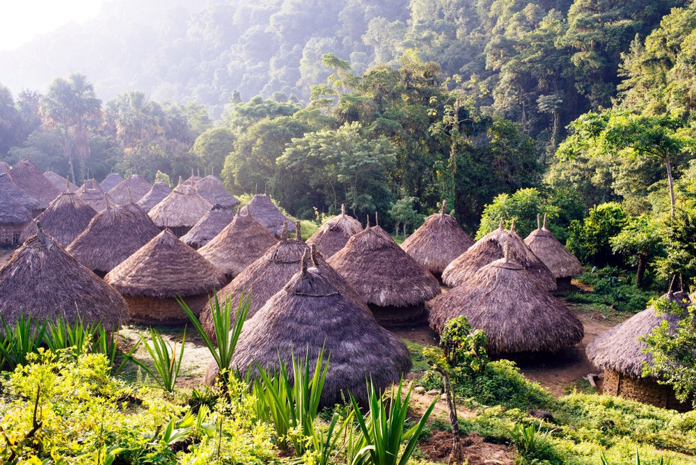
According to archaeologists, the ancestors of the Wayuu settled in this arid desert roughly 10,000 years ago. At the time of conquest, they resisted the Spanish, one of the few peoples on the continent never to be militarily subdued. This resistance stems from their mastery of the territory, the use of horses acquired from colonists and their dispersal into matrilineal clans.
Today, the Wayuu live from weaving, fishing and subsistence farming. They possess their own language, Wayuu (or Wayuunaiki), spoken alongside Spanish. Craftsmanship structures social life: the bags crocheted by women, called mochilas, have become emblematic of Colombie and represent an important income source. Tightly woven hammocks (chinchorros) are another cornerstone of their textile production.
What to see and do
Riohacha, gateway
Capital of the department, Riohacha serves as a logistical base. The city remains modest, but its long wooden pier, beaches and artisan market allow you to spend half a day before heading into the desert. This is where local agencies, lodging and money exchange points are concentrated.
Cabo de la Vela
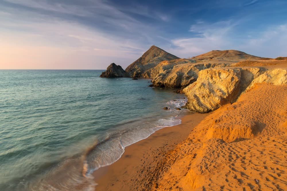
A Wayuu fishing village facing the sea, Cabo de la Vela is known for the Pilón de Azúcar, a rocky promontory overlooking an isolated beach. The site has also become a recognized kitesurfing spot thanks to constant winds. Accommodation is in simple posadas or hammocks, with electricity available only a few hours per day.
Punta Gallinas and the Taroa dunes
The northernmost point of the South American subcontinent, Punta Gallinas is reached after several hours on trail from Cabo de la Vela. The Taroa dunes plunge directly into the sea; the highest reaches roughly 60 meters. Sandboarding is the main activity, but the site's appeal lies above all in its rare landscape: shifting dunes, Bahía Hondita bay, pink flamingos in the lagoons.
Makuira National Natural Park
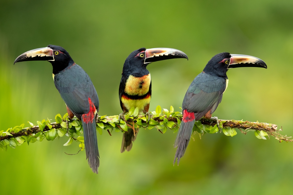
At the far northeast, Makuira park serves as both a nature reserve and indigenous reserve, inhabited by roughly fifty Wayuu families. This mountainous enclave forms an oasis of mist in the middle of the desert, with its own high-altitude humid forest and remarkable bird biodiversity. Access requires authorization and a local guide.
Mayapo and Uribia
Closer to Riohacha, Mayapo beach has specialized in water sports (kitesurfing, windsurfing), with a few schools for beginners. Uribia, nicknamed Colombie's "indigenous capital," serves as a transition point toward the deep desert; its market allows you to stock up and observe Wayuu textiles.
Palomino, on the edge
Before entering the arid zone, Palomino village marks the transition with the Sierra Nevada. From the beach, on clear days you can see the snow-capped peaks of the range. Waves suit surf beginners and the nearby river can be traveled by tube.
Practical information
- Organization: the majority of travelers go through an agency in Riohacha for a 2 to 4-day 4x4 circuit with driver-guide. Independent travel remains possible but complex (unmarked trails, poor connectivity).
- Accommodation: family posadas, Wayuu rancherías, nights in hammocks. Sparse comfort beyond Riohacha.
- Water and food: bring water reserves; access to potable water is very limited in the peninsula.
- Children's roadblocks: on the trails, Wayuu children stretch a rope across the road to ask for biscuits, candy or provisions. It is customary to bring stock to distribute rather than money.
- Language: Spanish is essential; little English is spoken. A few words of Wayuunaiki are appreciated in communities.
When to go
The Guajira is the hottest and driest place in Colombie. Temperatures remain high year-round, moderated by northeast trade winds. The rainy season, concentrated from October to November, makes trails to Punta Gallinas difficult or impassable: this is the period to avoid for a complete circuit. Colombian high season (December-January and Holy Week in March-April) brings crowds to Cabo de la Vela; it's better to book in advance.
How to get there
Almirante Padilla Airport in Riohacha is located roughly 3 km from the city and receives flights from Bogotá and Medellín. You can also arrive by road from Santa Marta (3 to 4 hours by bus) or from Cartagena. Beyond Uribia, no regular buses serve the desert: travel is by jeep or truck, usually as part of an organized circuit.
What to combine in the region
The Guajira fits logically into an itinerary along Colombie's Caribbean coast. From Santa Marta, many travelers continue to Ciudad Perdida, a pre-Columbian city accessible after several days of trekking in the Sierra Nevada. Further south, Medellín and its transformed neighborhood of Communa 13 offer stark urban contrast, as does the Gold Museum of Bogota, which illuminates the country's pre-Columbian civilizations.
Frequently asked questions
Frequently asked questions
Plan at minimum 3 days / 2 nights from Riohacha to reach Cabo de la Vela and Punta Gallinas. A 4-day circuit allows you to include Makuira park and travel at a more reasonable pace given the long trails.
Technically yes up to Cabo de la Vela using shared transport from Uribia, but beyond that the lack of signage, connectivity and transport makes independent organization very difficult. The vast majority of travelers go through a local agency in Riohacha.
Tourism is organized there and standard itineraries proceed without major incident. The main challenges stem from the department's poverty (children's roadblocks, panhandling) and isolation (limited medical care, possible mechanical breakdowns). Border zones with Venezuela warrant heightened caution.
For Makuira park, yes. For the rest of the peninsula, agencies partner with Wayuu families who lodge travelers and often serve as cultural liaisons.
The mochilas woven by Wayuu women are the most emblematic purchase. Expect several days of work per bag: the low prices practiced locally reflect compensation for demanding craftsmanship.
Prepare your trip
The Guajira is part of a broader Colombie itinerary blending Caribbean coast, Andes and pre-Columbian culture. To build a coherent circuit integrating this Wayuu territory, explore our tailor-made journeys in Colombie.
Interested in this visit?
We can include it in your personalised itinerary.