Laguna del Otún
Laguna del Otún
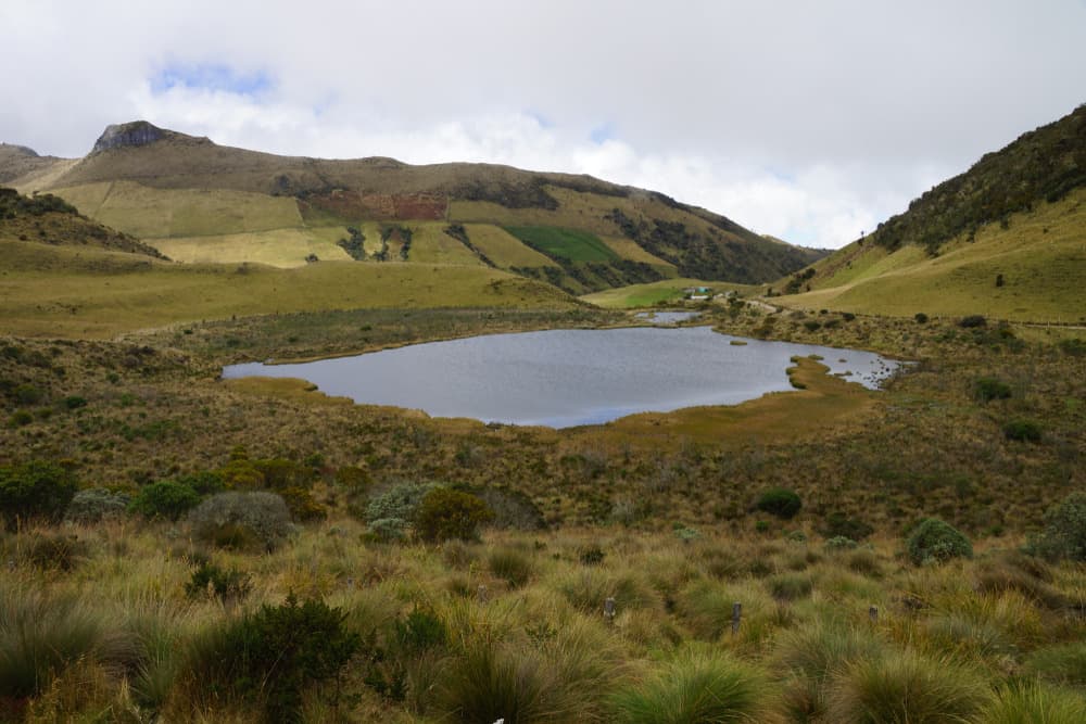
Sacred lake of the Quimbaya at 3,950 m elevation, Laguna del Otún is one of the major hiking objectives in Los Nevados National Park, Colombia.
Laguna del Otún is a high-altitude lake located at 3,950 meters above sea level in Los Nevados National Natural Park. Covering 1.5 km², it lies in the municipality of Santa Rosa de Cabal, east of Risaralda Department. Accessible from Pereira, capital of the Coffee Triangle, it ranks among the most demanding hiking objectives in Colombia's Páramo landscape.
Why visit Laguna del Otún
Three factors make Laguna del Otún singular in Colombia's natural portfolio. First, its ecosystem: the Páramo, an Andean high-altitude biome found only between Colombia, Ecuador, and Venezuela, functions as a natural water reserve. Second, its status: the lake is listed among wetlands of international importance under the RAMSAR convention. Third, its hydrological role: it feeds the Otún River and supplies drinking water to Pereira, making it a strictly protected site subject to rigorous regulations.
The hike suits prepared walkers only. Altitude, elevation gain, and the variability of Andean climate demand solid fitness and proper gear. In return, the trail crosses several ecological zones, with landscapes shifting as you climb toward the Páramo.
History and cultural significance
Before Spanish colonization, Laguna del Otún was considered sacred by the pre-Columbian Quimbaya culture, which occupied much of what is now the Coffee Triangle. The word Cocora, associated with the neighboring valley, means "starfish" and also named a Quimbaya princess, bearing witness to this civilization's symbolic attachment to water and Andean heights.
Geologically, the lake results from volcanic and glacial formation. It is fed by the melting of Nevado Santa Isabel, one of the snow-capped peaks in Los Nevados National Park. This mixed origin explains the purity of its waters and the fragility of the hydrological balance it depends on, which is why access is strictly controlled.
What to see on site
The trail and its landscapes
The marked path ascending to the lake crosses Andean forests, high-altitude grasslands, and rocky zones. The trek is punctuated by streams, wildflowers, and—on clear days—views of Nevado del Ruiz, an active volcano visible from several trail sections. Landscapes unfold in stages as tree vegetation gives way to Páramo species.
The frailejones
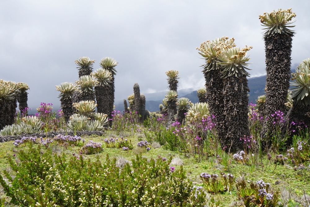
On the western slopes of the basin grow frailejones, emblematic Páramo plants with thick, downy leaves topped by yellow flowers. Their growth is extremely slow: about one centimeter per year. They are genuine natural water reservoirs, capable of storing water from high-altitude mists and releasing it gradually to the soil. Seeing them, you witness directly the mechanism that makes Páramos the water towers of the northern Andes.
Cocora Valley and wax palms
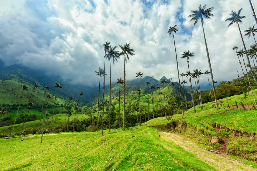
Southeast of the park, Cocora Valley extends the experience for those with time. It shelters Ceroxylon quindiuense, an endemic wax palm reaching some sixty meters, considered the world's tallest palm and Colombia's national symbol. The valley extends across an area often estimated at 580 km² and forms part of Los Nevados National Park's buffer zone.
When to go
The region experiences two dry seasons—December to March and July to August—the most favorable periods for hiking: clear visibility, less muddy trails, open views of snow-capped peaks. April-May and October-November concentrate the heaviest rainfall and make the ascent significantly more difficult. Whatever the season, high-altitude mountain climate remains unpredictable: pack warm and waterproof clothing.
How to get there
Access is from Pereira, connected to Bogotá by overnight bus or flight (roughly one hour). From Pereira, the classic route passes through El Cedral, the trailhead accessible by local shared transport such as chiva buses. The route then ascends by stages: El Cedral, La Pastora, El Jordán, then El Bosque. The complete hike requires several days, and many walkers split the climb by staying overnight at a refuge in La Pastora.
A second entry point exists from Santa Rosa de Cabal to the northeast. On the trail, mules or horses can be rented for luggage transport, easing the altitude burden.
Practical information
Entry to Los Nevados National Park is charged and collected by rangers upon arrival, with rates differentiated for Colombian residents and foreign visitors. Verify current fees with park authorities before departure.
Several restrictions apply: access is forbidden to children under 6, persons over 70, and pregnant women. Campfires are prohibited (bring a camping stove) and pets are not allowed. Bring personal medications, water, snacks, a cold-adapted sleeping bag, hiking boots, and warm clothing for high-altitude nights. Staying on marked trails and removing all waste are essential to preserve the site.
To see in the region
The Coffee Triangle and Los Nevados National Park offer other complementary attractions: Nevado del Ruiz and Nevado del Tolima, Paramillo del Quindío, plus several high-altitude lakes (Laguna Verde, Laguna Negra, Laguna La Leona) and the El Cisne visitor center. To expand your Colombian itinerary, continue toward Ciudad Perdida in the Sierra Nevada de Santa Marta, or toward urban centers like La Candelaria in Bogotá and Comuna 13 in Medellín.
Frequently asked questions
Frequently asked questions
A solid level. The 3,950-meter altitude and cumulative elevation gain require solid fitness and prior acclimatization to minimize acute mountain sickness risks.
Most hikers spread the ascent over two to three days with one night in a refuge at La Pastora. A same-day round trip from El Cedral is extremely demanding and discouraged without high-altitude experience.
The dry seasons, December to March and July to August, offer the best visibility and most passable trails.
Yes. Access is forbidden to children under 6, persons over 70, and pregnant women. Campfires and pets are also prohibited in the park.
Yes. On clear days, Nevado del Ruiz is visible from several trail sections, and Nevado Santa Isabel dominates the lake basin.
Planning your trip
Laguna del Otún fits into a broader circuit around the Coffee Triangle and Los Nevados National Park, combined with coffee zone villages, Salento's landscapes, and Cocora Valley. To build a complete itinerary, consult our Colombia travel guide.
Interested in this visit?
We can include it in your personalised itinerary.