Los Nevados Regional Natural Park
Los Nevados Regional Natural Park
Active volcanoes, páramo, emerald lakes and giant wax palms: Los Nevados brings together 58,300 hectares of Colombia's most singular Andean landscapes.
The Los Nevados National Natural Park is the third most visited national park in Colombie. Located in the Central Cordillera of the Andes, in the heart of the Coffee Triangle, it covers 58,300 hectares and is home to five snow-capped peaks, rare páramo ecosystems found nowhere else on Earth, high-altitude lakes, and one of the country's most active volcanoes, Nevado del Ruiz.
Why visit Los Nevados
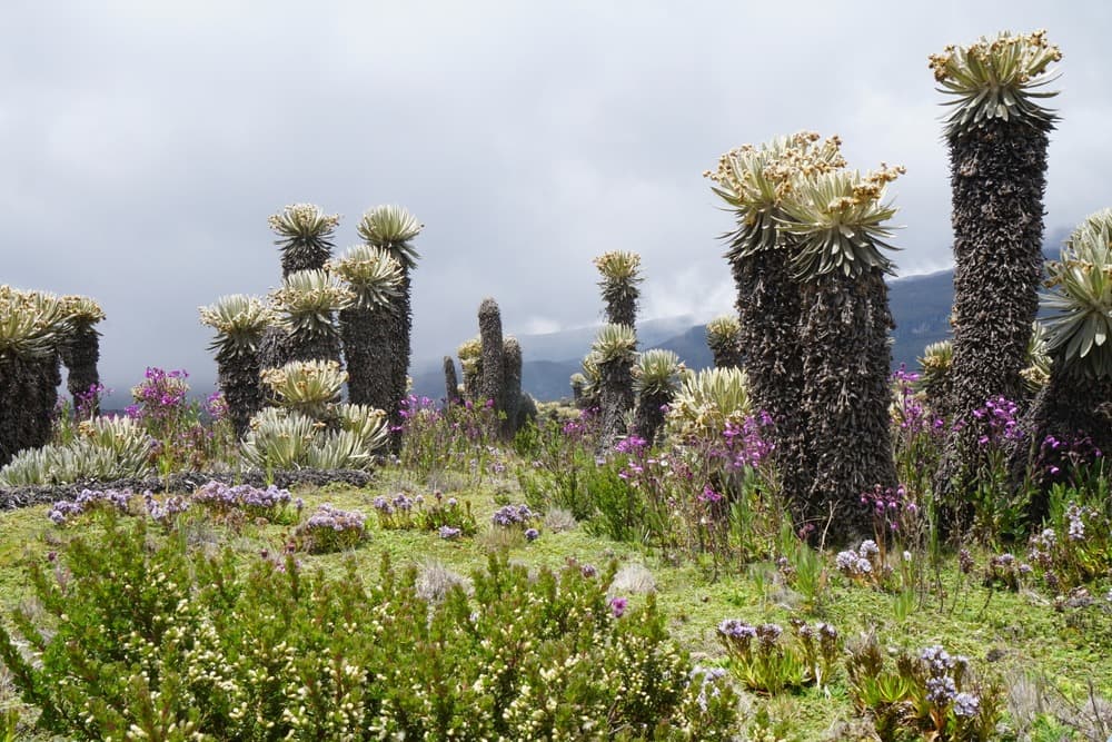
The park brings together elements rarely found in a single territory: active volcanoes accessible above 5,000 meters, endemic wax palms reaching up to 60 m, emblematic Andean wildlife (condor, spectacled bear, mountain tapir) and heritage sites of pre-Columbian Quimbaya cultures. The páramo, a tropical high-mountain ecosystem present only in the northern Andes, makes it a recognized scientific observation point.
The routes cover varying levels, from family hiking in the Cocora Valley to the technical ascent of Nevado del Tolima.
History and recognition
Five peaks dominate the park: Quindío, El Cisne, El Ruiz, Santa Isabel and Tolima. The area was declared of natural interest in 1974, largely due to the rarity of its páramo ecosystem and the concentration of tropical glaciers it still harbors.
On November 13, 1985, at 21:08, Nevado del Ruiz erupted for approximately four hours. The heat melted part of the ice cap and triggered lahars — volcanic mudflows — that traveled more than 100 km down the valleys. The town of Armero was buried and over 23,000 people lost their lives. The event remains one of the deadliest eruptions of the twentieth century and profoundly shaped volcanic risk management in Colombie.
What to see and do
Nevado del Ruiz and its craters
Rising to 5,321 m, Nevado del Ruiz is the only peak in the park accessible by vehicle, up to a high-altitude starting point. The route leads through snowfields and sulfurous hot springs toward two craters: Alto de la Piraña and La Olleta. Access depends strictly on volcanic activity: the sector can be closed without notice.
Cocora Valley
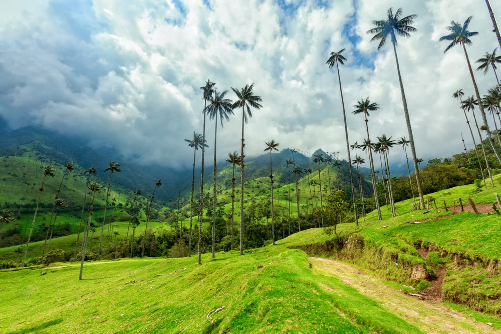
Adjacent to the park, in its southern sector, the Cocora Valley offers a loop achievable in about 2 hours. It winds through high-altitude meadows planted with wax palms, Colombia's national tree, which can exceed 60 m. The trail is marked and accessible without a guide, unlike the rest of the park.
High-altitude lakes
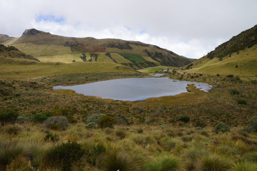
- Lago Verde: its emerald-green water is due to volcanic sediments in suspension.
- Lago Otún: a historic worship site of Quimbaya culture, located in the park's northern sector.
Desert of Solitude
Also called Valley of Tombs, this high-altitude mineral landscape was a pilgrimage site for the Quimbaya and Puyas peoples. Pale soils, sparse vegetation and silence make it one of the park's most singular sites.
Flora and fauna
The park records 300 varieties of lichens, 200 species of bryophytes and 180 macroscopic fungi, indicators of a minimally disturbed environment. On the fauna side, you can observe the Andean condor, ruddy duck, chamois hummingbird, hoatzin, as well as the mountain tapir, white-eared opossum, spectacled bear, northern pudu and cougar.
Practical information
The park is divided into two main sectors: Norte (access from Manizales, toward Nevado del Ruiz) and Sur (access from Salento or Ibagué, toward Cocora and Nevado del Tolima). Some of the trails cross private land and are not fully marked: a local guide is strongly recommended outside of Cocora.
Park entry is paid (different rates for foreign visitors) and is settled at control posts. The altitude (often above 4,000 m) requires prior acclimatization and attention to altitude sickness.
When to go
The park can be visited year-round, but two periods are more favorable: December to February and July-August, which correspond to the driest seasons in the Central Cordillera. Ascents of the snow-capped peaks are planned during these windows. The wettest months (April-May and October-November) bring fog, rain and reduced visibility. Access to Nevado del Ruiz also depends on volcanic activity monitored by the Colombian geological service.
How to get there
Three cities serve as entry points: Manizales and Pereira (both with domestic airports) for the northern sector, and Salento for the southern sector and Cocora Valley.
- From Bogotá or Cartagena: domestic flight to Pereira or Manizales, then car or bus.
- From Cali or Medellín: direct buses to Pereira, Manizales or Armenia.
- From Salento: shuttle or Willys jeep to the Cocora entrance.
What to see in the region
The Coffee Triangle deserves several days: colorful villages (Salento, Filandia), coffee-producing fincas and hot springs at Santa Rosa de Cabal. Further afield, sites like the archaeological park of Villa de Leyva or Comuna 13 in Medellín complement a Colombian itinerary centered on the Andes. For museum lovers, Bogotá houses reference collections such as the Gold Museum and the Botero Museum.
Frequently asked questions
Frequently asked questions
To include Los Nevados in a complete itinerary, consult our journeys in Colombie.
Interested in this visit?
We can include it in your personalised itinerary.